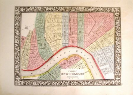
405 Plan of New Orleans
Plan of new Orleans, Maker: Samuel Augustus Mitchell, Jr., 1864, Philadelphia, 11" x 9". Condition: Very Good+. Attractive plan of the City of New Orleans with decorative border showing Mississippi River to Algiers, parks and trolleys. The map is hand colored by wards. Shows streets, buildings, rail lines, etc. An attractive city plan from the pre-eminent commercial publisher of the era.